Monitoring the dynamics of deforestation in the highlands of the Namuli mountains
Namuli: a national heritage to be preserved
The Namuli forests are an ecosystem that ensures the survival of local communities and the economic development of the Gurué district and Zambézia province. According to Nitidæ, nearly 46% of Namuli's forests were cut down between 2000 and 2022. See the landscape study carried out by Nitidæ in 2020.
This loss of forest cover is due to the opening up of new agricultural plots to grow Irish potatoes (the main source of income for local communities). When these plots lose their productivity, they are left fallow for a few years to allow the soil fertility to regenerate. This dynamic explains the presence of areas of secondary vegetation on the Namuli uplands.
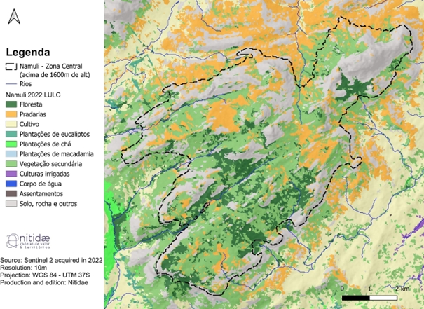
Map of the Namuli Mountains land cover and land use in 2022
The main objective of the Namuli project, which Nitidæ has been implementing since 2019, is to conserve the ecosystems and biodiversity of the Namuli mountains in order to strengthen their capacity to provide essential services, ensure the continued sustainable development of this area and improve the living conditions of local communities.
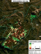
The project aims to create a community conservation area in the Namuli mountains. To achieve this, Nitidæ is using its expertise in remote sensing techniques and the production of land use and land cover maps to monitor changes in forest cover in the central zone of the Namuli mountains (all the land above 1600m altitude, located within the dotted curve on the map below). These analyses feed into action strategies, such as the negotiation of conservation agreements and forest ecosystem restoration activities with the Namuli communities.
Map of land use and land cover in the Namuli mountains (2022)
In 2022, Nitidæ produced a map describing land cover and land use in the central area of the Namuli Mountains. This work identified five categories of land cover in the work area: forests, grasslands, agricultural or cultivated areas, areas of secondary vegetation and areas with other cover (mainly rock). The statistics relating to land use and land cover are presented in the table below.
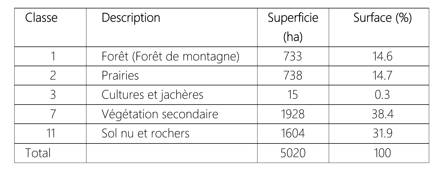
Statistics on the representation of different types of land cover and land use on the map (Nitidæ, 2022)
The areas of standing forest cover 733 ha and represent 14.6% of the central area of Namuli. These are forests with a closed canopy around 20-25 metres high (Timberlake et al., 2009). Areas of secondary vegetation may be natural or partially cleared (former potato fields) and/or frequently affected by fire. These areas cover 1928 ha and represent 38.4% of the core zone. Today, they are at the heart of restoration activities carried out with local communities. Mountain meadows cover 738 ha (14.7% of the total area). Like the forests, they are biodiversity hotspots that need to be preserved. The agricultural land identified in the central zone (Irish potato fields currently under cultivation) covers a total area of 15 ha. Due to their small size, some farmland may have gone unnoticed or been confused with areas of secondary vegetation during the analysis. see the report here.
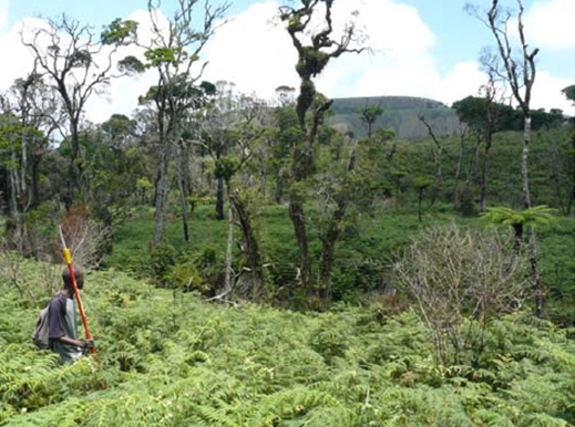
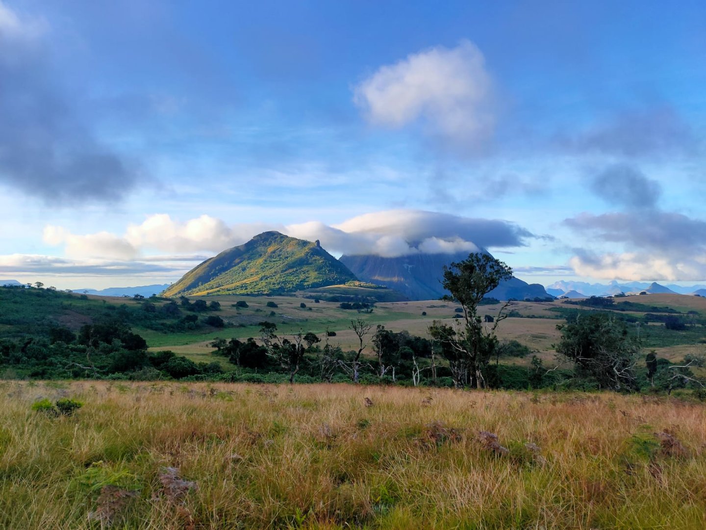
Photo of a plot of secondary vegetation in the Namuli highlands (a potato field left fallow for at least a year.)
By comparing the results obtained in 2022 with the work carried out in previous years, it has been possible to retrace the history of deforestation in the area.
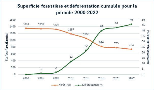
Changes in forest cover and deforestation between 2000 and 2022
Analysis of the rate of deforestation and forest cover over the years (see figure above) shows a peak in deforestation between 2015 and 2018. Since 2019, this trend has reduced, but remains unsustainable given the small area of remaining forest (733 ha in 2022).
Related projects
NAMULI 2 - Creation of a new protected area around Mount Namuli in Mozambique
See moreRelated documents
Mount Namuli - Community conservation area in the Republic of Mozambique