
Advanced training in remote sensing for the establishment of a clearing monitoring system for the Mabi-Yaya Nature Reserve in Côte d'Ivoire
Context
Today in Côte d'Ivoire there are a variety of solutions for monitoring changes in forest cover, whether monitoring deforestation, forest degradation or regeneration. These are ad-hoc national systems developed for national authorities involved in land management and national programs (e.g. REDD+), or turnkey systems developed on a pantropical or even global scale, by international research institutes and available to the general public. Despite considerable development efforts, these monitoring systems have difficulty in being deployed among conservation and sustainable development stakeholders because they produce information of a different, sometimes divergent, nature which is difficult to translate into human activities on the field, which explains their low operational use.

IMAGES national deforestation monitoring system with its early warnings detected at the level of the Mabi-Yaya Nature Reserve

Global Forest Watch pantropical deforestation monitoring system with its integrated alerts at the level of the Mabi-Yaya Nature Reserve
The issue of monitoring deforestation and in particular of humid forests in Côte d'Ivoire is at several levels, in particular: 1) the persistence of clouds almost throughout the year, 2) the speed of the processes involved (e.g. days, weeks) and 3) the spatial fineness of the processes (e.g. cutting or mortality of isolated trees due to selective cutting or method of cocoa production). Earth Observation (Remote Sensing) data and tools offer solutions to measure and detect these changes reliably and repeatedly over time on large areas. However, no solution is perfect, and it is necessary to fully understand the existing solutions (advantages and limits) and know the possibilities of developing your own monitoring system according to your expectations and priorities (choice of the method for detecting changes, type alert, monitoring frequency, minimum detection unit, etc.).
Objective
The Ivorian Office of Parks and Reserves (OIPR) is a national public institution whose mandate is to conserve Ivorian protected areas by ensuring their management, development and protection. Currently, 8 national parks and 6 nature reserves are managed by OIPR.
In order to strengthen its operational capacity in the field by improving its monitoring, the OIPR asked Nitidæ to train around fifteen of its agents from November 28 to December 2, 2022. The main objective of this training was to develop skills in remote sensing of these agents and to train them to master and use a deforestation alert and monitoring system designed by Nitidæ specifically for OIPR. This system has been designed to be as useful and relevant as possible for agent control missions.
The Mabi-Yaya Nature Reserve in the Mé region was chosen as an application case for this proposed monitoring system. However, the latter is also applicable to any other protected area or classified forest in Côte d'Ivoire.
The 3-day theoretical training module aimed in particular at the following objectives:
- Acquire knowledge and a good understanding of existing monitoring systems (advantages, limitations);
- Master relevant satellite data production tools (date, resolution, indices);
- Produce a deforestation alert bulletin dedicated to the intervention in the field.
The module was followed by a verification/validation mission of several alerts with the two N’Lab trainers in order to more effectively support the OIPR in clearings monitoring.
Training at the office of the South Zone Directorate of OIPR in Abidjan
The training of OIPR agents at the office of the South Zone Directorate went well. The first day concerned the review of the various alert systems/platforms on deforestation (Global Land Analysis & Discovery, RAdar for Detecting Deforestation , Global Forest Watch and IMAGES) with manipulations on these platforms, in particular for the selection and downloading of alerts. The post-processing of these alerts in the QGIS software was also seen in order to know how to draw the desired information from them. The second day involved reviewing tools for collecting satellite images (Earth Explorer, Planet on QGIS and Google Earth Engine) with basic manipulation on each of the platforms (automatic production of composite images without clouds for example). Finally, the office phase ended on the third day with the production in QGIS of deforestation alert bulletins by the participants. This consisted of seeing all the stages of preparation and manipulation of the data necessary for the bulletin, then how to lay it out and produce it automatically.

All the participants of the training in the premises of the Direction of the South Zone of the OIPR

Example of a sheet of the deforestation alert bulletin produced during the training
Field mission in the Mabi-Yaya Nature Reserve in the Mé region
The second phase of the training took place over two days in the Biéby and Kossandji sectors of the OIPR in charge of the management of the Mabi-Yaya Nature Reserve. This mission also went well with the verification of 7 alerts including 5 GFW alerts and 2 IMAGES alerts. All the alerts turned out to be positive with the presence of anthropogenic activities linked to cocoa-growing: young plots of 6-12 months or 2-3 years old, and also adult plots of 10-15 years old. Clearing of the undergrowth without a marked opening in the canopy corresponding to the first stage of setting up a field in the forest has even been detected, although the robustness of this type of alert needs to be confirmed.

Confirmed alert linked to the cocoa-culture of a young plot of 6 to 12 months

Confirmed alert linked to the cocoa-culture of a plot of 2-3 years maintained

Burning the base of larger trees kills them standing. It is a simple and inexpensive method used by cocoa growers to open up the canopy to allow their plants to grow
Conclusion
At the end of the training, the OIPR agents expressed their satisfaction while asking for the production of more didactic materials in order to be more autonomous. In this same idea, they also reaffirmed their interest in being trained on pure remote sensing in the event of a potential next training session in order to also be able to have a method for detecting "in-house" deforestation alerts.
In order to perpetuate this action and to ensure the autonomy of the OIPR on the subject, a detailed and didactic training material was produced in the months that followed. The second training session, more on pure advanced remote sensing, has been validated and is taking place this week in Côte d'Ivoire.
These trainings and supports are carried out within the framework of the PRM2 project: "Preserve the biodiversity of Mabi-Yaya & Strengthen the socio-economic development of the Mé", financially supported by the French Fund for the Global Environment (FFEM) and the Delegation of the European Union (EUD) in the Republic of Côte d'Ivoire.
Related projects

Mé REDD+ Project - To tackle deforestation and forest degradation in the Mé region
See more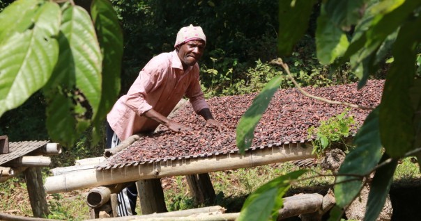
PRM2 - Preserve the biodiversity of Mabi-Yaya & Strengthen the socio-economic development of the Mé
See moreRelated documents

Slides presented during the OIPR training in Côte d'Ivoire for the evaluation of deforestation monitoring tools
